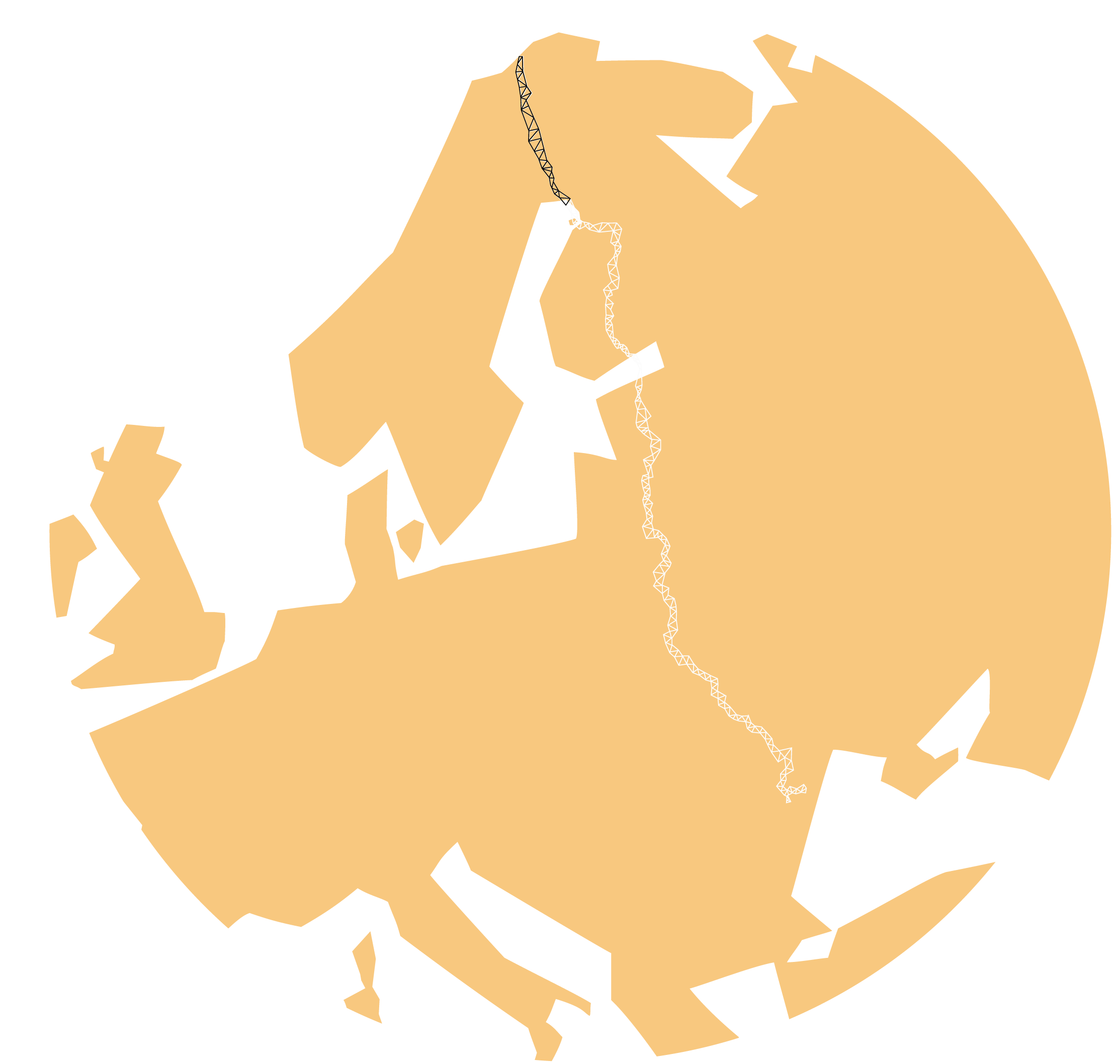
Struve Geodetic Arc, our joint heritage

Struve Geodetic Arc is not just one destination – it’s a journey.
Struve Geodetic Arc was nominated to the World Heritage list on 15th July 2005.
World Heritage
is the designation for places on Earth that are of outstanding universal value to humanity and as such, have been inscribed on the World Heritage List to be protected for future generations to appreciate and enjoy.
Official sites of Struve Geodetic Arc in Finland, Sweden and Norway
- www.struve.fi
- www.struve.no
- https://www.lansstyrelsen.se/norrbotten/besoksmal/varldsarv/struves-meridianbage.html
What does the project do?
The idea behind the project has come out of the need to improve the accessibility and knowledge of the Struve Geodetic Arc. Accessibility is one of the key challenges to be addressed in cooperation with regional actors.
One of the solutions is to add digitally accessible multilingual material from different points and also from places with good view points, such as the view of the Alatornio Church and Perävaara from Victoria market area at the border of Tornio and Haparanda.
Digital Solutions
Digital solutions are utilized in the gamification of the Struve Geodetic Arc and in the modeling of triangle measurements. Collaborative innovations are key to raising awareness, capacity building and shared learning, through using smart technologies. The implementation seeks to find new perspectives for sharing information on the Struve measurement points, which have not attracted visitors or residents in the area previously. Once the critical knowledge and skills are available, the Geodetic Arc points can be used as learning platforms as well as in tourism.
Inspiration and skills for sustainable tourism development
Changes in people’s values create demand for sustainable tourism products and services. Today’s traveler is aware and looking for adventure, but also looking for opportunities to learn and discover local attractions. The project will generate information for the needs of tourism companies and tourists alike, and will also provide companies with workshops to design sustainable services and products. The work will begin at the information events in the spring, and continue in the autumn in the form of workshops.
Capacity building
Thematically, the scientific-historical Geodetic Arc provides a framework for learning mathematics, history, biology, geography, art and sports among others. The “Ever wanted to be an explorer” concept, developed in Oravivuori site, is modeled on a learning journey with primary schools. This learning project in the footsteps of Struve achieved three general objectives of basic education: cultural competence, interaction and expression, thinking and learning to learn, and working life skills and entrepreneurship.
Collaboration and networks
International co-operation is a resource that can also be utilized in production and learning solutions. While hard work and bureaucracy are often associated with internationalization, the Struve Geodetic Arc network aims at concrete actions that enhance smooth development of cross-border solutions.


