


By Jarno Niskala, project coordinator, City of Tornio
The Alatornio church in Tornio, Finland, is one of the few buildings that was used as a measuring point. The Church tower is similar today as it was back in the 1840-1850. Seeing inner constructions of the tower makes people amazed by the skills of past timbers. From the balcony scientists were able to see Kivalo, Perävaara and Kaakamavaara with their equipment. Kokkomäki is another point close to the church. Kokkomäki had one of the few preserved original marks in the beginning of the 1900s inventory. Today the spot can be found, but there is some gravel work done on the hill.
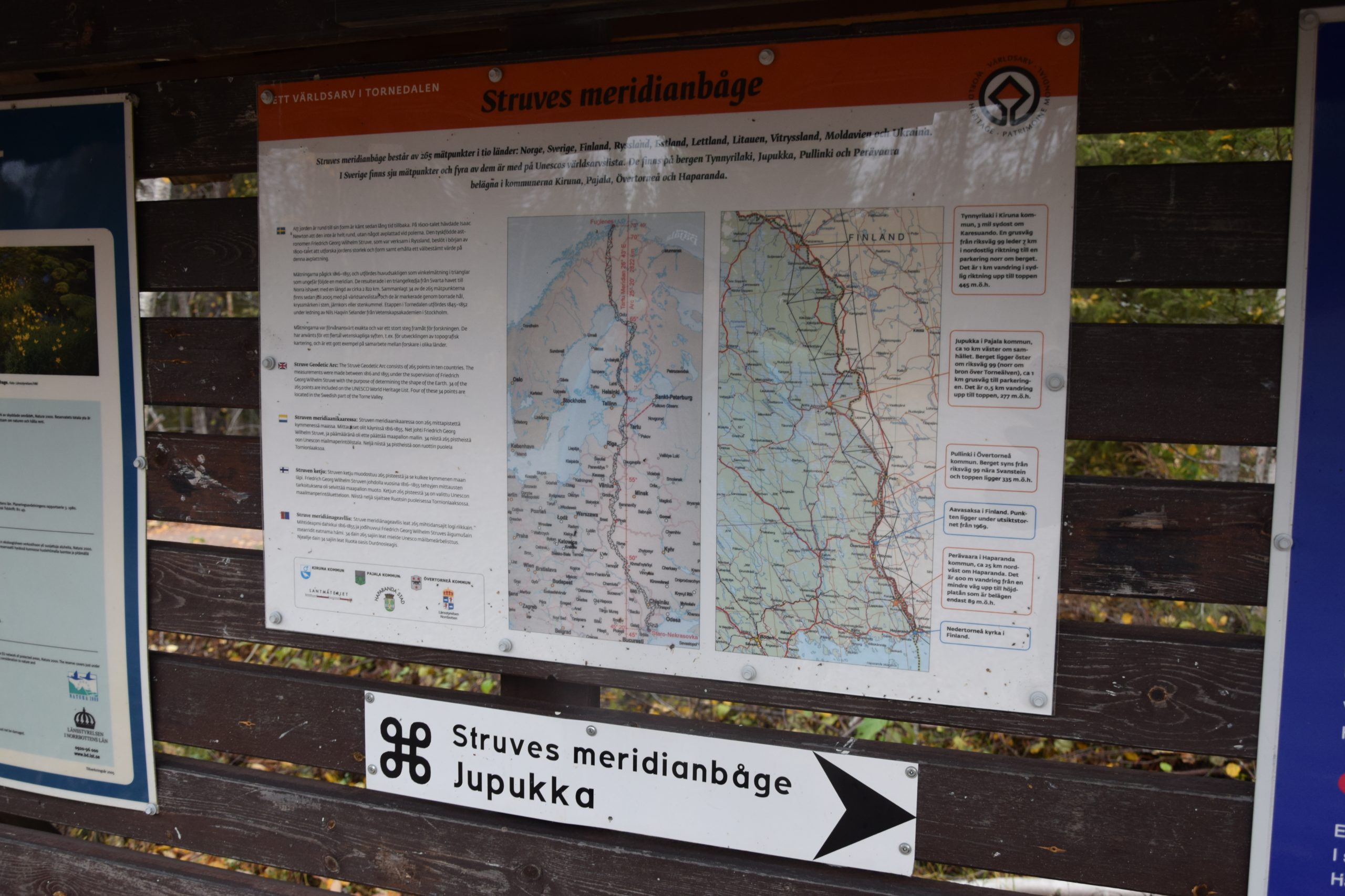
World heritage signs in Jupukka.
Photo Jarno Niskala.
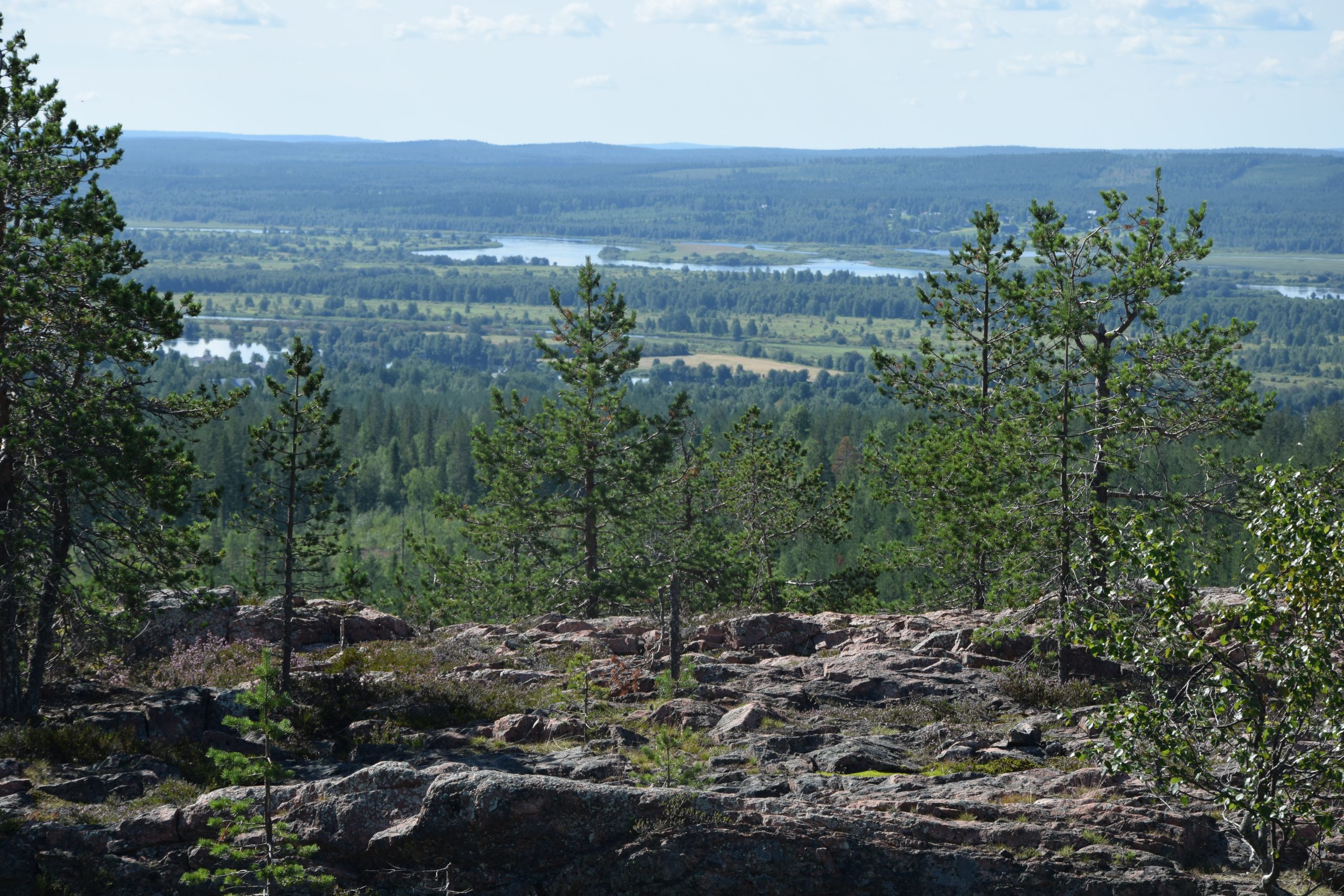
View in Huitaperi.
Photo Jarno Niskala.
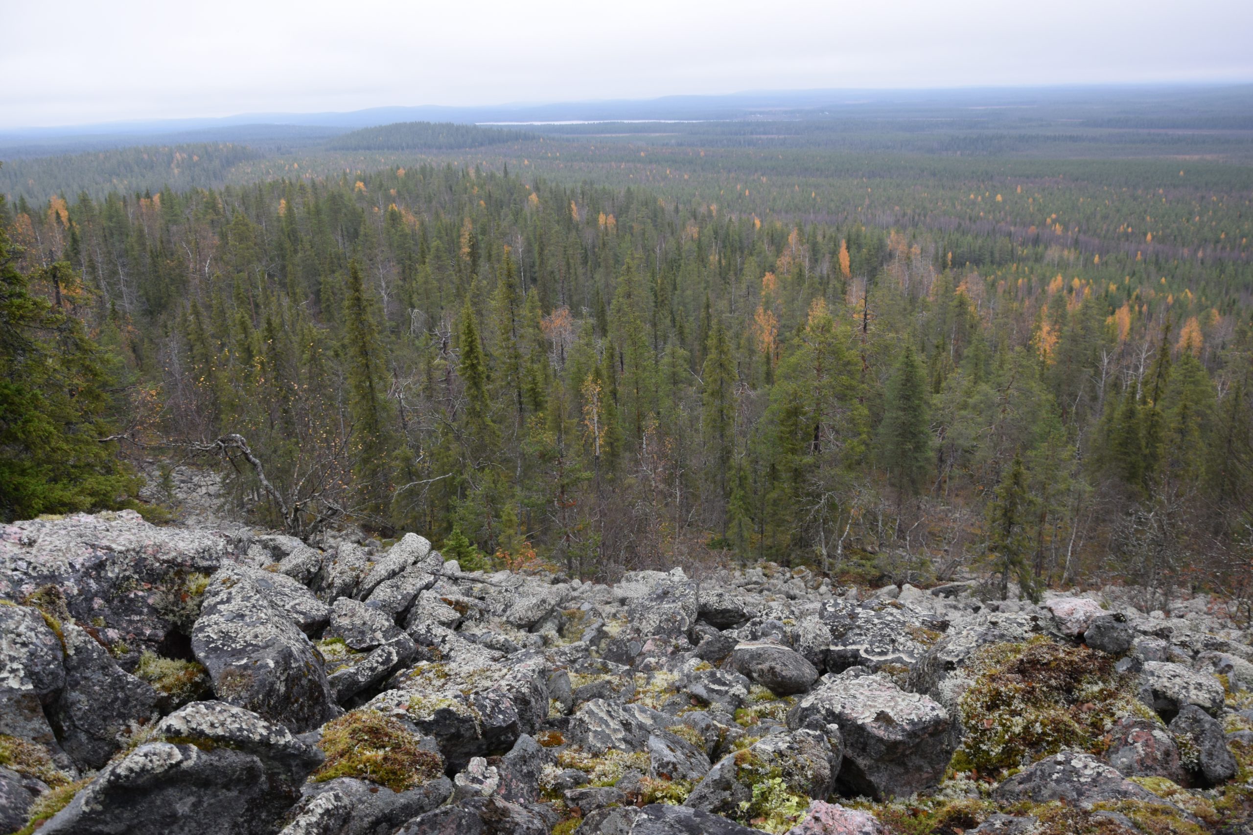
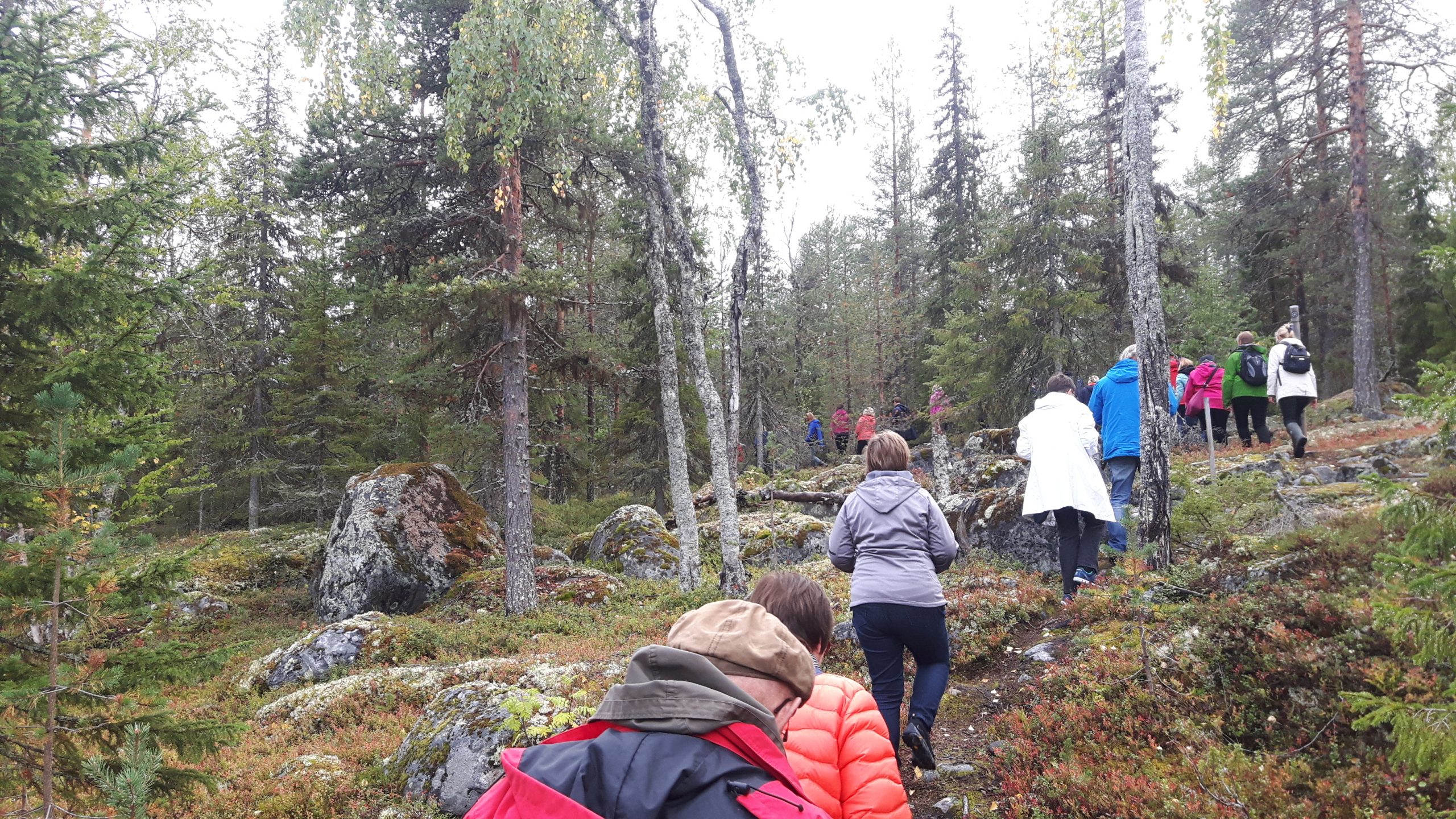
Paljukkavaara wilderness.
Photo Jarno Niskala
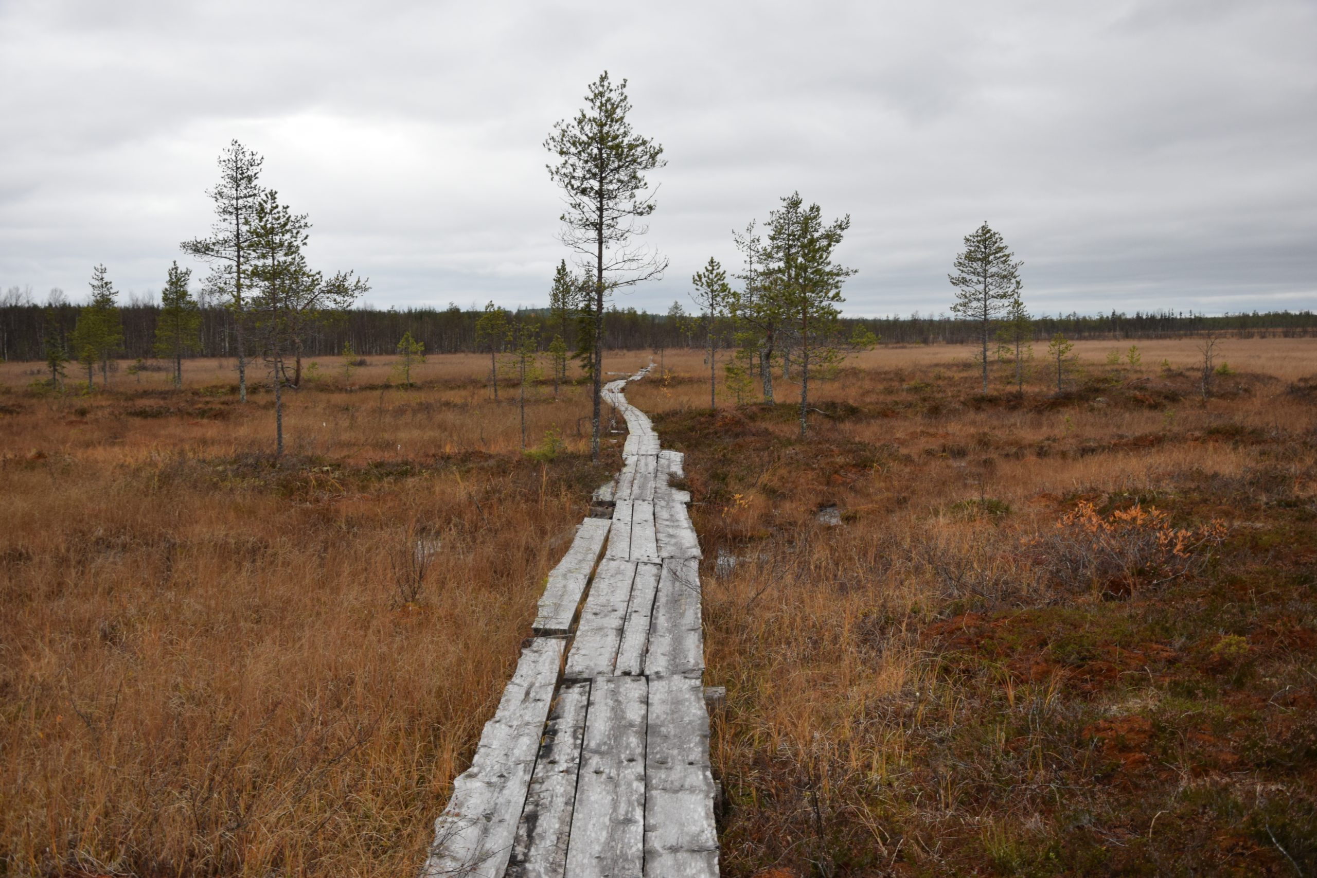
Heinävuoma, Sieppijärvi.
Photo Jarno Niskala.
Perävaara, Sweden is a World Heritage Site.
Perävaara in Haparanda, Sweden, is a World Heritage Site. Photo: Eila Seppänen

Alatornio church in the winter.
Photo by Jarno Niskala.
Perävaara is the hill in western side of Kukkola, belonging to Haaparanta municipality in Sweden. It is some kilometers inland from the river but a small road leads you nearby. Perävaara is also an UNESCO protected site like the Alatornio church. The place makes you imagine different ways how scientists were able to see other measuring points from here. The hill is quite forested. There is at least one place on the way, where the river is visible. Kaakamavaara on the East side is the highest hill in Tornio. It is located close to the Palovaara village. There are interesting slate stone formations all over Kaakamavaara. You can see Kemi and Tornio from the top. Nahkiaisoja historical farm is located close to the mountain. In the same latitudes, Nivavaara in Korpikylä is a good sightseeing place to different measuring points, also for quicker visits. There is a good hiking path and also a fire place.
Huitaperi is an interesting mountain in Kainuunkylä, Ylitornio municipality. Maupertuis was able to see from there straight to Tornio in the 1700s. It is not that far from the river. There is a marked path to the top once you find the place where it starts. Huitaperi is known for rare white lingonberries. In addition to Huitaperi, in Kainuunkylä the visitor got a thorough presentation to the whole village and its miracles. Going towards the north, there comes Aavasaksa, which is one of the oldest tourist attractions in Finland and also an UNESCO site. Fine newly constructed paths around the top and a classic Torne valley view are really worth to see. Horilankero and Niemivaara are the next closest points. Niemivaara is a naturally beautiful mountain by Ajanki lake. Stone formations there remind of man-made walls and staircases. Reminding also of Luppio on the Swedish side.Kittisvaara in Pello has an easy location close to the river and Pello village. It is famous especially from the older observations in the 1700s. In Sieppijärvi one can hear lots of history from locals. The Museum and the Laestadius path are close to the Struve point in the Ylinenvaara mountain. The Laestadius path goes from Sieppijärvi to Lappea and to Köngänen on the Swedish side. People used to go to listen to Laestadius by using this path.
In the wilderness, south of Pajala, there is Paljukkavaara mountain. It is wonderfully natural with untouched forests and quietness. Here you can see bear tracks here and there. And there are no routes or paths here!
Jupukka, that used to be Kerojupukka, is the UNESCO point that is close to the Pajala village. It certainly has its characteristic. There is a fireplace on the top and the whole top is a beautiful open sheep pasture. Also nice views. Kiuaskero is on the border of Kolari and Muonio. Views are amazing. The road to the area leaves from the Tapo river (Tapojoki). There are no marked routes but it is relatively easy to find because the top is open and stony. However finding back is much more difficult. Olostunturi / Olosmountain is east of Muonio village. There are some constructions on the top and on the side of the mountain, so it is not in its natural stage. But still you can see far. In the Muonio area there are many cultural sights, which help you to find stories and imagine how it was there over 100 years ago. For example from Torassieppi, a traditional village, you can see Olostunturi well and get to know the village that was preserved from the war. The Struve Geodetic Arc seems to offer enjoyable time in nature and opens up a journey to the past in Torne Valley.