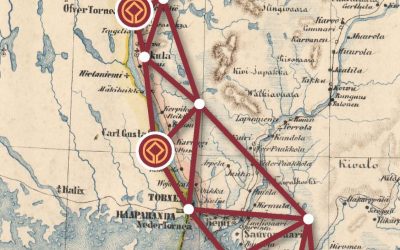
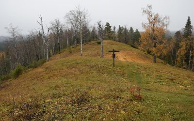
Contents of this page Tornio attracted scientists The Alatornio church and Kokkomäki hill as station points Astronomy research station...


At the Top of the World Heritage
The Northern parts of the World Heritage Struve Geodetic Arc
The Northern parts of the World Heritage Struve Geodetic Arc project aims to improve the accessibility and knowledge of the Struve Geodetic Arc in Finland, Sweden and Norway.
About the Project
World Heritage is near us all, who live along a route from Haparanda-Tornio to Hammerfest. Realization of the fact that the Northern parts of the Struve Geodetic Arc provide an unique platform for authentic experience of science, history and nature, and not too many people utilize the opportunity yet, got us to apply for Interreg North financing for a joint cross-border project. We want to tell more stories of the Struve Geodetic Arc, combine and digitize knowledge of the Struve Geodetic Arc and surrounding area, and enable new learning experiences and product development – at the top of the World Heritage.
Stories
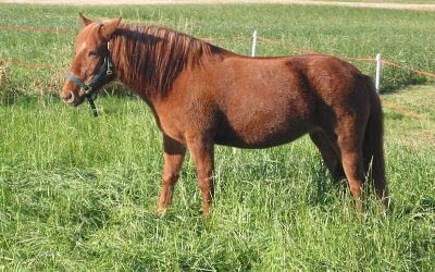
Along the journey: Tornio Valley horse
Sometimes we find interesting reading when we look for information about Struve’s measurements in the Torne Valley and Northern Norway. Like this one about the Tornio Valley horse (Tornedalshäst) or the Lyngen horse.
Visits to sites in 2020
The Struve Geodetic Arc points have an interesting historical background and are usually surrounded by wonderful nature. Jarno Niskala, project coordinator working in Tornio gives some details of the sites situated in Torne Valley.
Contact Us
Lapland University of Applied Sciences:
eila.seppanen @ lapinamk.fi
Visit Struve Geodetic Arc
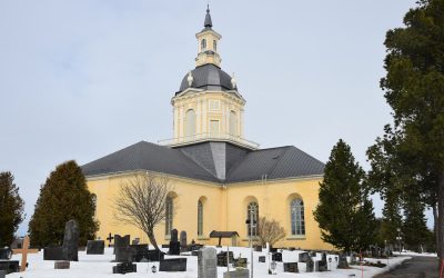
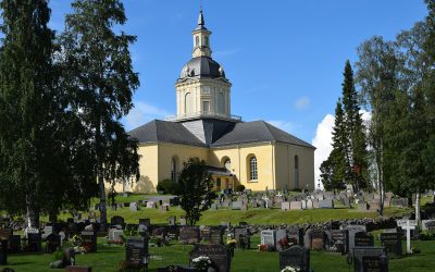
Alatornio church, Finland
Location Alatornio, Tornio, Lappi, Finland Coordinates Lat. 65° 49' 48" NLon. 24° 09' 26" E Address: Kirkonmäentie 85 , 95450 Tornio.Height of tower 40 metres above sea level. Status Unesco World Heritage List, Site No. 11Measurement point of the Struve Geodetic Arc...
Aavasaksa, Finland
Location Aavasaksa, Ylitornio, Lappi, Finland Coordinates Lat. 66° 23' 52" NLon. 23° 43' 31" EHeight ~242 m Status Unesco World Heritage List, Site No. 10 Measurement point of the Struve Geodetic Arc No. 31 Main station pointMap of the area Sightlines to Pullinki,...
Stuorrahanoaivi, Finland
Location Stuorrahanoaivi. Enontekiö, Lappi, Finland Coordinates Lat. 68° 40' 57" N Lon. 22° 44' 45" E Height ~600 m Status Unesco World Heritage List, Site No. 9 Measurement point of the Struve Geodetic Arc No. 16 Main station point Astronomical station point Map of...
Perävaara, Sweden
Location Perävaara. Haparanda, Norrbotten, Sweden Coordinates Lat. 66º 01' 05'' NLon. 23º 55' 21'' EHeight 89 m Status Unesco World Heritage List, Site No. 8 Measurement point of the Struve Geodetic Arc No. 34 Main station pointMap of the area Sightlines to Huitaperi,...
Pullinki, Sweden
Location Pullinki. Övertorneå, Norrbotten, Sweden Coordinates Lat. 66° 38' 47'' NLon. 23° 46' 55'' EHeight 335 m Status Unesco World Heritage List, Site No. 7 Measurement point of the Struve Geodetic Arc No. 30 Main station pointMap of the area Sightlines to...
Jupukka, Sweden
Location Jupukka. Pajala, Norrbotten, Sweden Coordinates Lat. 67° 16' 36'' N Lon. 23° 14' 35'' E Height 277 m Status Unesco World Heritage List, Site No. 6 Measurement point of the Struve Geodetic Arc No. 24 Main station point Map of the area Sightlines to...

